FOUR LAKES TASK FORCE
  • About
    • History
    • Who We Are >
      • Team Bios
    • Operations
    • Secord Dam
    • Smallwood Dam
    • Edenville Dam
    • Sanford Dam
  • Restoration Progress Report
  • Donate
    • Why Donate?
    • Our Donors >
      • Corporate Sponsors
      • Individual Donors
    • Four Lakes Legacy Society
  • Events
  • Documents
    • Annual & Quarterly Reports
    • Audited Financials
    • Dam Construction Updates
    • Engineering Reports & Studies
    • Flyers & Brochures
    • Meeting Presentations
    • News Flashes & Newsletters
    • Published Statements
    • Restoration Plan 2021
    • Tax Filings & Governance
  • Resources
    • Erosion Control >
      • Project Map
      • Project Permitting
      • What You Can Do
    • FOIA Request
    • Frequently Asked Questions
    • Lakebottom Information
    • Subscribe
    • Updates
  • Special Assessment District
    • Assessment Maps
    • FAQs
    • Prepayments
  • Contact

Lakebottom Information

Fishing Locations

Posted July 26, 2023
Due to active construction at Secord, Smallwood and Tobacco dams, public fishing access at all three sites will be closed for the duration of construction. 
[fishing locations currently hidden from site]
  • Tobacco Spillway - east side of the water channel below the dam
  • Smallwood Dam - southeast side of water channel below the dam (McKimmey Rd. entrance)
  • Secord Dam - both sides of the water channel below the dam

Recreation

Acceptable Activities
Typical recreation when conducted responsibly includes:
  • Access to docks or other structures that have been permitted by the respective county permitting authority; the permitted upland property owner; or FLTF on behalf of the respective county
  • Hiking or fishing in unrestricted public areas
  • Use of open federal, state, local or private boat ramps
  • Sightseeing
  • The permitted upland property owners have a right to access the bottomlands from their property
  • Non-resident access is only allowed from unrestricted public access points along the four lakes
  • Waterfowl hunting and fishing consistent with previous use and following all state and federal rules and regulations, Individuals do so at their own risk. See fishing access points above
  • Dogs or other animals must be under immediate control
  • Kayaking, canoeing, boating and swimming provided all state and federal rules and regulations are followed. Individuals do so at their own risk
  • Mowing/weed whacking by property owners at the edge of their shorelines following guidelines​
THESE GUIDELINES DO NOT CONSTITUTE AN INVITATION TO ACCESS OR USE THE BOTTOMLANDS THAT WERE FORMERLY LAKES.  ALL ENTRY AND ACTIVITY IS AT THE USER'S SOLE RISK.  NEITHER GLADWIN NOR MIDLAND COUNTIES NOR FOUR LAKES TASK FORCE ASSUME ANY LIABILITY FOR DAMAGES, INJURIES OR DEATH RESULTING FROM ACCESS TO, OR ACTIVITIES UPON THE BOTTOMLANDS.

FAILURE TO FOLLOW THESE RULES ON THE BOTTOMLANDS OWNED BY MIDLAND AND GLADWIN COUNTIES WILL CONSTITUTE A TRESSPASS AND RENDER VIOLATORS SUBJECT TO PROSECUTION.
What's Not Allowed 
Recreational activities that are 
more dangerous and NOT permissible per the rules include:
  • Deer or upland game hunting
  • Rifle hunting (hunting with shotguns, in compliance with state hunting regulations and bottomland use rules is permitted)
  • Setting animal traps
  • Camping
  • Open fires or burn areas
  • Bike riding
  • Horseback riding
  • ORV (outdoor recreational vehicle) or snowmobile riding
  • Trailers or RVs
  • Digging or otherwise disturbing the ground on the bottomlands without a permit
  • Stump removal
  • Building or placing structures on the bottomlands (i.e. pools, tiki huts, etc.)

What Requires Permission
Activities requiring permission that must be reviewed by FLTF first:
  • Cutting stumps, small trees and shrubs without causing rutting or disturbance of sediment to lower injury potential or damage to boat props. Cut logs must be removed from bottomlands. STUMPS ATTACHED TO THE LAKEBOTTOM CANNOT CANNOT BE REMOVED WITHOUT A PERMIT FROM EGLE
  • Debris removal and/or recovering lost property are permitted provided the activity is performed safely and the debris is disposed of properly
  • Installation of permanent docks requires an EGLE permit
To receive permission to cut stumps/trees, download the form and email the completed version to [email protected]. In your email include a description of the activity and the person/people performing it. After sending the signed Accident Waiver and Release of Liability Form, FLTF will give you a letter of permission for the activity.

If a public service group activity is being planned such as a community flood debris cleanup day, FLTF will work with you on gaining permission.
These lists are not comprehensive. Contact FLTF with questions.

Safety

The May 2020 flooding event significantly changed the Four Lakes bottomlands. The water levels at Four Lakes will continue to be abnormally low due to the need to make dam repairs and/or dam section replacements. Water levels may rise or fall unexpectedly due to weather events or construction activities. This means that the public may encounter hazards when traversing the shorelines, bottomlands or waters of the Four Lakes that did not previously exist. Therefore, when visiting the bottomlands, the public should take the new conditions of the area into consideration. Due to environmental erosion and habitat concerns that exist therein, the bottomlands are not intended for unlimited recreational use. Limited use is encouraged to protect the health of the property and the safe use of resources.

Managing vegetation

There is no provision under state law for the Part 307 Delegated Authority to raise money to improve the lake itself, other than to maintain the water level. This means FLTF does not have the authority to assess property for vegetation control on the lakebottoms.

Any questions about vegetation control should be directed to the appropriate authority listed below.

Picture
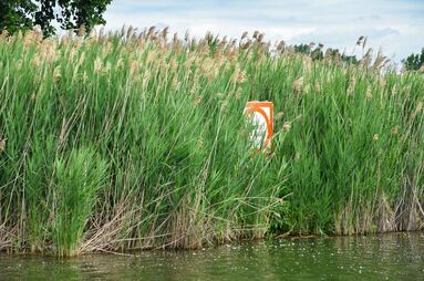
Invasive phragmites can grow to be 15 feet tall with many stems in a small area. Source: MSU Extension Michigan Sea Grant
Lake
Township
Vegetation Control Authority
Secord
Secord, Clement, Bourett
Your township
Smallwood
Hay, Secord
Your township
Wixom
Tobacco west of M-30
Your township
 
Tobacco east of M-30
Wixom Lake Improvement Board
  
Edenville, Hope, Billings
Wixom Lake Improvement Board
 
Hay
Your township
Sanford
Jerome
Sanford Lake Improvement Board
  
Edenville
Your township

Dredging

 FLTF has the authority under Part 307 of Public Act 451 of 1994 to establish and maintain a legal lake level. Part 307 does not grant FLTF the general authority to manage the water depth in the lake (i.e., dredging). A Part 309 lake improvement board has the authority to dredge lakes. The same is true for a township under the Public Improvements Act, Public Act 188 of 1954.
​
Those who are interested in dredging should consider collaborating with their neighbors to find solutions. Dredging in the lakebed requires a permit from the Michigan Department of Environment, Great Lakes, and Energy. Please reach out to your county drain commissioner or township supervisor for more information.
Do not delete hidden element - code for search bar
Questions?
Contact Us
About Us
Meet the board
Read our history
See our supporters
Learn More
Frequently asked questions
Special Assessment District
View documents
See updates
Get Involved
Donate
Attend a meeting
Contact us
Subscribe for email updates

Ask a question • Get our emails
©2025 | Four Lakes Task Force is a US 501 (c)(3) public charity, EIN 27-4698447. This institution is an equal opportunity provider.
Four Lakes Task Force
  • About
    • History
    • Who We Are >
      • Team Bios
    • Operations
    • Secord Dam
    • Smallwood Dam
    • Edenville Dam
    • Sanford Dam
  • Restoration Progress Report
  • Donate
    • Why Donate?
    • Our Donors >
      • Corporate Sponsors
      • Individual Donors
    • Four Lakes Legacy Society
  • Events
  • Documents
    • Annual & Quarterly Reports
    • Audited Financials
    • Dam Construction Updates
    • Engineering Reports & Studies
    • Flyers & Brochures
    • Meeting Presentations
    • News Flashes & Newsletters
    • Published Statements
    • Restoration Plan 2021
    • Tax Filings & Governance
  • Resources
    • Erosion Control >
      • Project Map
      • Project Permitting
      • What You Can Do
    • FOIA Request
    • Frequently Asked Questions
    • Lakebottom Information
    • Subscribe
    • Updates
  • Special Assessment District
    • Assessment Maps
    • FAQs
    • Prepayments
  • Contact